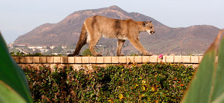
Photo credit: Sherry Kempster
Introduction and Summary
Several years ago, the Ventura County Board of Supervisors (BOS) directed the County Planning Division to develop regulations that would protect habitat connectivity and wildlife movement corridors within the non-coastal areas of the county. On March 19, 2019, the BOS approved new regulations related to wildlife movement in addition to a Habitat Connectivity and Wildlife Corridor map identifying those areas that are subject to the new regulations. The mapped wildlife corridors that were used for the project came from South Coast Wildlands as part of the South Coast Missing Linkages project (SCML 2008).
The project objectives include the following: minimize indirect barriers, such as outdoor night lighting; minimize direct barriers, such as impermeable fencing; and minimize vegetation and habitat fragmentation. Based on these objectives, several regulatory mechanisms were added to the County’s zoning ordinance. In general, the regulations provide safeguards for certain development in particularly sensitive locations such as surface water features, wildlife crossing structures, and critical wildlife passage areas.
More specifically, the ordinance includes regulations to:
- Minimize impacts of outdoor night lighting by regulating brightness, shielding, light direction, etc.
- Limit disturbance around surface water features and important road crossings, as these areas are especially important for wildlife movement.
- Minimize the amount of impermeable fencing that can be installed without a permit.
- Encourage compact siting of structures in three key “Critical Wildlife Passage Areas” within the Corridor.
- Prohibit intentional planting of invasive plants.
Why do Corridors Matter?
Wildlife corridors (or linkages) connect fragmented patches of habitat. The main goal of a corridor is to facilitate movement of plants and animals through dispersal and migration. The fragmentation of natural areas within Ventura County can occur from development patterns such as removal of native habitat, or the construction of buildings, roads, and fences. This fragmentation can degrade or eliminate the functionality of a wildlife movement corridor and limit the ability of plant and animal populations to disperse and move to areas they need for survival. This issue is considered among the most urgent of biological resource concerns. Wildlife biologists consider the maintenance or enhancement of existing habitat connectivity linkages, or connections between large, natural areas of protected habitat, as well as the native vegetation linkages within such corridors, as essential to ensure the future health of the County’s natural resources.
Corridor Project Data and Details
As noted above, the Board of Supervisors approved the project in March 2019. Links to the regulations and approved Corridor maps are below:
- Final Habitat Connectivity and Wildlife Corridor Ordinance Ord. 4537
- Map of the Habitat Connectivity and Wildlife Corridor overlay zone
- Map of the Oak View Critical Wildlife Passage Area
- Map of the Simi Hills Critical Wildlife Passage Area
- Map of the Tierra Rejada Critical Wildlife Passage Area
A common misunderstanding about the Habitat Connectivity and Wildlife Corridor Ordinance is that it prohibits people from developing their property. This is not the case. Landowners can develop new homes, conduct agricultural and other industrial activities, build additions to existing homes and accessory structures. However, some new regulations apply.
Regulations Summary
In general, if a property is within a Habitat Connectivity and Wildlife Corridor, but not within a “Critical Wildlife Passage Area” the following regulations would apply to new development. (Note that italicized terms below are defined in the ordinance.)
- Outdoor night-lighting regulations that address fixture brightness and shielding apply to new development. Some outdoor lights need to be turned off between 10:00 p.m . and sunrise, or when people are no longer present, except for essential lighting (e.g., those used for walkways), which can be left on.
- Development within a surface water feature or within 200 feet of an identified wildlife crossing may require a discretionary permit. Ministerial permits may be issued solely for the removal of invasive plants. New structures that do not require a building permit pursuant to the existing zoning ordinance or do not require brush clearance for fire prevention purposes, and removal of vegetation associated with the harvesting of commercial agricultural crops, are exempt from the proposed regulations.
- The amount of wildlife impermeable fencing that can be installed is limited. The fencing regulations only apply to lots zoned Open Space (OS) or Agricultural – Exclusive (AE). Examples of impermeable fencing include electric, chain link, welded wire, mesh fence (plastic or wire material), wrought iron, and any fencing with a solid surface such as wood panel fencing or cinderblock). Standard pipe corrals and wire strand (including barbed wire) cattle fencing are not regulated provided they are not higher than 60 inches above grade. Generally, an over-the-counter (ministerial) permit is required if the amount of land enclosed by impermeable fencing is limited to ten percent or less of the gross lot area (e.g., on a 20-acre parcel, two acres can be enclosed with impermeable fencing). A discretionary permit is required only if the amount of land enclosed by impermeable fencing exceeds ten percent. All wildlife impermeable fencing within 50 feet from any dwelling or a principal structure related to agriculture, is exempt from the ten-percent limitation. Additional exemptions include impermeable fencing used to protect commercial agricultural crops.
- The intentional planting of invasive plants is prohibited unless they are being planted as commercial agricultural crops or grown as commercial nursery stock. An “invasive plant” is any species of plant included on the California Invasive Plant Council Invasive Plant Checklist for California Landscaping, as amended. https://www.cal-ipc.org/plants/inventory/about-the-inventory/
Critical Wildlife Passage Areas (CWPAs)
There are three Critical Wildlife Passage Areas (CWPAs) located within the boundaries of the larger Habitat Connectivity and Wildlife Corridors: an area between Oak View and Lake Casitas; the Simi Hills including Bell Canyon, Box Canyon, and the Santa Susana Knolls; and the Tierra Rejada Valley.
Planning Division staff, in consultation with wildlife experts, identified these areas as being particularly critical for facilitating wildlife movement based one or more of the following factors: (1) the existence of intact native habitat or other habitat with important beneficial values for wildlife; (2) proximity to water bodies or ridgelines; (3) proximity of critical roadway crossings used by wildlife; (4) likelihood of encroachment by future development, and within which wildlife movement and plant dispersal could be easily disturbed by development; or (5) presence of non-urbanized or undeveloped lands within a geographic location that connects core habitats at a regional scale.
Specific CWPA regulations require more compact development to help maintain undeveloped areas that serve as linkages for wildlife movement.
The compact siting standards apply only to lots over two acres in all zones except those zoned Commercial and residentially zoned lots within the Simi Hills CWPA, which are exempt.
If the proposed development is to be located on an undeveloped parcel, the first principal structure/use may be located anywhere on the parcel as otherwise authorized by the Non-Coastal Zoning Ordinance. All other subsequently permitted development must meet at least one of the following criteria:
- The development must be located entirely within 100 feet of the centerline of a public road or a publicly accessible trail;
- The development must be located entirely within 100 feet of any portion of, and on the same lot as an existing, legally established structure; or
- The development must be located entirely within 100 feet of and on the same lot as the centerline of an agricultural access road the supports the production of commercially grown agricultural products.
If the proposed development requires a ministerial permit such as a single-family house, the development would still be considered ministerial, if at least one of the criteria listed above it met.
If the development does not qualify for a zoning clearance, (i.e., if none of the criteria listed above are met, or the development already requires a discretionary permit, such as a dog kennel), then a discretionary permit would be required.
How were the Corridors Identified?
A scientific research project called the South Coast Wildlands Project mapped wildlife corridors through Ventura County. The data and corridors generated by this project continue to be used throughout Southern California (including Ventura County) and are considered a standard resource for the evaluation of environmental impacts during the environmental review process for discretionary development. The mapped corridors from this study provide the basis for development regulations to protect habitat and wildlife corridors.
These reports can be accessed at the following website:
For an overall review of the South Coast Missing Linkages Regional Report (Summary)
For the detailed report on the methods used to develop the linkage design for the Santa Monica-Sierra Madre Connection.
For the detailed report on the methods used to develop the linkage design for the Sierra Madre-Castaic Connection.
Stakeholder Meetings
The Planning Division hosted three meetings to receive stakeholder input on habitat connectivity and wildlife movement corridors. Key topics for discussion included issues related to fencing, lighting, native vegetation removal, and maintaining corridor widths - all of which are important to wildlife movement.
- August 8, 2017 Meeting Presentation is attached here.
- August 8, 2017 Meeting Notes are attached here.
- August 14, 2018 Meeting Presentation is attached here.
- August 14, 2018 Meeting Notes are attached here.
For further questions about the Habitat Connectivity and Wildlife Corridor Ordinance, please contact: Abigail Convery at (805) 654-2489 or via email at This email address is being protected from spambots. You need JavaScript enabled to view it. or Shelley Sussman at (805) 654-2493 or via email at This email address is being protected from spambots. You need JavaScript enabled to view it.